
LiDAR technology has become an essential tool for mapping, surveying, and monitoring the environment. Two popular lidar systems on the market today are the Greenvalley LIAIR X3 LiDAR and the Rockrobotics R2A LiDAR. In this blog, we will compare these two systems, highlighting their differences and similarities, to help you decide which one is the best fit for your specific needs. Please note the pricing listed in this page is in USD.

HARDWARE

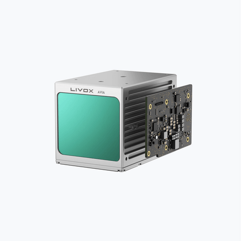
It's important to mention that both systems utilize the Livox Avia LiDAR sensor, which is known for its impressive features such as a maximum detection range of 450 meters, a range precision of 2cm, and a point rate of up to 240,000 pulses per second.
When it comes to physical characteristics, both systems are designed to be compact and lightweight, making them easy to integrate with a wide range of UAVs currently available on the market (Matrice 300 RTK, Matrice 600, etc.). The LiAir X3 is slightly more lightweight, weighing in at 1.25kg, compared to the R2A's weight of 1.3kg.
Both systems come equipped with an integrated RGB camera, which allows for colorization of the point clouds. The LiAir X3 has a slightly higher resolution camera with 26 megapixels, compared to the R2A's 24 megapixel camera.
The R2A system has a distinctive feature - its SLAM capabilities. By paying an extra $6000 per year for SLAM processing and $3300 for the mobile mount, this system can perform mobile mapping, enabling users to switch from aerial mapping to vehicle-mounted scanning.
|
|
Rock R2A |
|
|
LiDAR sensor |
Livox AVIA |
|
|
Weight |
1.3kg |
1.25kg |
|
Camera |
Sony A5100 24MP |
26 MP Camera |
|
IP Rating |
None |
IP64 |
|
System Accuracy |
± 5 cm |
|
One of the key advantages of the X3 is that it has an IP64 rating, meaning it is completely protected against dust and is protected against water splashed from all directions, limited ingress permitted.. This feature is particularly useful as drone operations are not always conducted in optimal weather conditions. The ability to withstand harsh environments makes the X3 a reliable option for any kind of outdoor operation.
SOFTWARE
When considering a LiDAR system, it's important to also take into account the software used for data processing and analysis. Both the Greenvalley LIAIR X3 Lidar and the Rockrobotic R2A Lidar come with their own software solution. However, there is a key difference in the licensing models. Greenvalley offers a perpetual licensing model with unlimited usage, while Rockrobotic uses a cloud-based software subscription model. This is a crucial factor to consider when making a purchase, as it can greatly impact the overall cost and flexibility of the system.


The LiAir X3 hardware pricing package includes LiGeoreference, an offline software that allows you to process raw data into a georeferenced point cloud file. This feature is also available with Rockrobotic's PCMaster and PCPainter desktop preprocessing software ($2000 USD). It is an essential feature as it enables you to validate and verify your data on-site before leaving the work location.
The next step after obtaining a point cloud is to use the Greenvalley LiDAR360 framework software for point cloud visualization and post-processing to generate deliverables. This software offers modularity, allowing users to purchase only what they need, and has industry-specific modules such as forestry, powerline, and mining. Many clients use the Terrain module in conjunction with LiDAR360 to generate terrain deliverables such as DEM, DSM, and DTM, which are available as perpetual licenses with unrestricted usage. The LiDAR360 framework costs $3,000 USD, with the Terrain module priced at an additional $1,500 USD for a total of $4500 USD.
Rock Cloud offers three subscription plans that range from $708 to $2,388 per year, or $1,188 to $4,188 per year when billed monthly. These plans have storage limitations, with the cheapest plan offering 50GB and the business plan offering 500GB. This can be useful for individuals without access to high-end computers with enough processing power in addition to the ability to share data with clients or stakeholders without the need for special software. However, it should be noted that a reliable internet connection is required to upload large amounts of data, and depending on the size of your project, the 500GB of storage may be quickly used up.
|
GVI |
Rock Robotics |
||
|
LiGeoreference |
Included |
Rock PCMaster |
$2000 |
|
LiDAR360 Framework |
$3000 |
Rock Cloud |
$708-$2388+/year |
|
Terrain module |
$1500 |
Rock Surveyor token |
1 token/10 acres |
|
Forestry module |
$1500 |
Rock Planimetrics token |
1 token/acre |
|
Powerline module |
$1000 |
Rock Vegetation token |
10 tokens / mile |
|
|
|
Rock Hydrology |
1 token/10 acres |

In addition to the subscription plans, Rock Cloud also requires the purchase of tokens on a pay-per-deliverable basis to process data into topographic deliverables. These tokens, which cost $20 USD each, are based on the acreage size of the data set. The benefit of this is access to the QA/QC expertise of the Rock Robotics team, which can be beneficial for those new to the LiDAR industry.
Based on our experience, a 200-acre point cloud can be as large as 250GB, which would consume half of the storage available on the Rock Cloud's business plan. Additionally, when accounting for the cost of tokens required to produce ground classification, contour break lines, and strip alignment using Rock Cloud's Surveyor estimator tool, the total cost for these data deliverables can reach as high as $5000 USD. All of which can be done in LiDAR360 + Terrain module at no additional cost and a gaming laptop with dedicated graphics card is sufficient to produce these deliverables in a timely matter.

In summary, LiDAR360 is geared towards professionals who have a clear understanding of their needs and require a comprehensive set of tools. On the other hand, Rock Cloud is designed for ease of use and convenience.
Both GreenValley and Rock Cloud are excellent systems from reputable companies that offer similar performance. However, the Rock Cloud system may have higher long run operating costs due to its recurring expenses.
Our consultants can advise you on a complete LiDAR drone solution including training. Contact us support@candrone.com or Live Chat with an expert now!
|
|
Rock R2A |
LiAir X3-H |
|
Hardware |
$19,995 |
$17,800 |
|
Pre-processing software |
$3000 (1 year, unlimited) |
Included (perpetual) |
|
Post-processing software |
$2388 (1 year) |
$3000 (perpetual) |
|
Terrain module |
$20/token @ 1 token/10 acres |
$1500 |
|
Base station |
$2800 |
$2800 |
|
Training / Support |
$2500 |
Included by Candrone |
|
Estimated total |
$30,683 for the first year.
Recurring: $5388 for subscriptions + tokens (not included) |
$25,100 (USD) |


