
In the ever-evolving landscape of drone technology, one feature remains surprisingly underutilized - Laser Range Finders (LRF). Traditionally, drone operations have leaned heavily on the pilot's visual assessments, relying on the image feed displayed on their remote controllers. While this approach undoubtedly provides valuable insights, it remains fundamentally qualitative in nature. However, what if we could add another layer to this process, one founded on precise quantitative data?

Enter Laser Range Finders, the key to that very question. They empower drone operators with the ability to make highly accurate range measurements by emitting an infrared beam towards a target and calculating the time it takes for the light to bounce back to the sensor. This data, in turn, equips the drone with the capacity to calculate the precise distance between itself and the target or triangulate the position of what the camera is looking at with impressive precision.

The applications of LRFs are as diverse as they are far-reaching. For instance, in the field of forestry, professionals utilize them to calculate tree heights, contributing to sustainable forest management. In the world of sports, LRFs assist golfers in gauging distances, thus aiding in critical decisions on club selection. However, the realm in which LRFs truly shine extends beyond these particular sectors.
Today, leading drone manufacturers like DJI and Autel have recognized the potential of Laser Range Finders. They have seamlessly integrated this technology into their drones, granting users access to a wide array of new capabilities and the ability to gather data that was once considered beyond reach.
Drones with LRF capabilities:
Zenmuse H20 series for Matrice 300/350
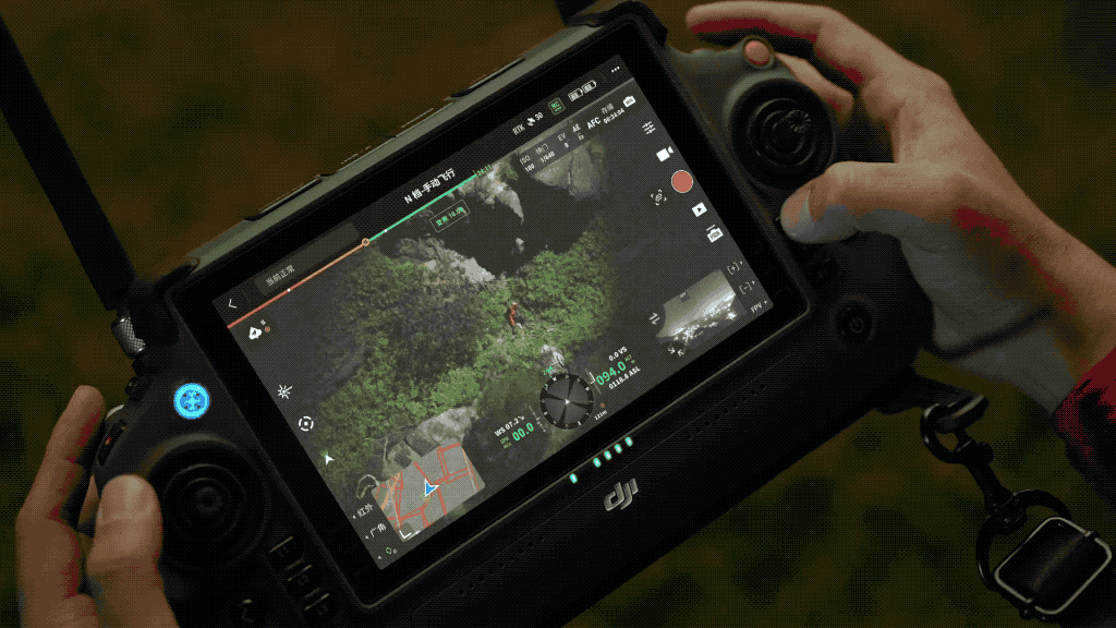
Imagine a scenario where you could point your camera's crosshairs at an object or area of interest and instantaneously receive its coordinates. DJI takes this a step further with its innovative "PinPoints" feature. This remarkable tool allows operators to pinpoint areas of interest and record their precise coordinates for future reference. What's more, users can annotate and customize the colors of these pins to suit their specific operation needs.
In practical applications, the value of LRFs becomes even more evident. In wildfire hotspot detection, drones equipped with thermal cameras have proven highly effective at spotting smoldering hot spots left by wildfires. While this is undeniably valuable, the challenge arises when numerous hot spots within an area need precise attention from helicopter crews. A drone outfitted with an LRF enables operators to create pinpoints on each identified spot, facilitating accurate and efficient water drops.
Search and rescue missions benefit significantly from LRF technology as well. Once a person has been located, the dilemma often centers around efficiently conveying their coordinates to ground or helicopter crews for extraction. Here again, the LRF comes to the rescue, making it possible to pinpoint the exact location.
For inspections, where precision is paramount, such as examining power poles that often line up uniformly, LRFs provide a solution. Operators can mark each pole with a pinpoint as they inspect it, preventing loss of track or identifying which poles require immediate attention.
Contact us today for your drone solution!


