

Candrone
GreenValley LiAir X3-H + Georeference
Request For Quote
Couldn't load pickup availability
GreenValley LiAir X3-H with LiGeoreference brings centimetre-level airborne LiDAR capture to demanding terrain surveys, enabling survey teams to collect accurate point cloud and mapping data without unnecessary weight or complexity.
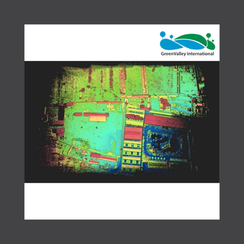
- Capture LiDAR and 26 MP imagery together: Produce true-colour point clouds and orthophotos for photogrammetry alongside LiDAR data in a single flight.
- Maintain accurate trajectory data: GreenValley's self-developed IMU supports precise georeferencing even with intermittent GNSS coverage.
- Monitor surveys in real time: Use GreenValley flight assistant for real-time point cloud display, parameter adjustment, and status monitoring on DJI M300/M350 RTK controllers with IP64 protection.
- Process data with LiGeoreference: Fuse GNSS, IMU, and raw LiDAR data into georeferenced point clouds ready for LiDAR360 or third-party processing.
Overview and Who It's For
The GreenValley LiAir X3-H with LiGeoreference combines a lightweight laser scanner, self-developed IMU, 26 MP mapping camera, and GreenValley's LiGeoreference post-processing software into a complete field-ready solution. With the optional handheld kit, the LiAir X3-H can also transition from airborne to ground-based scanning.
- Civil & Power: Supports survey teams requiring centimetre-level airborne LiDAR data, mapping imagery, and precise georeferencing across demanding terrain.
Key Specs
| Mapping camera | 26 MP |
| Protection rating | IP64 |
| Compatible UAV | DJI M300 RTK, DJI M350 RTK |
| Software included | LiGeoreference |
| Compatible processing software | LiDAR360, LiDAR360 MLS |
What's Included
- GreenValley LiAir X3-H x1
- LiGeoreference licence x1
FAQs
What is the GreenValley LiAir X3-H designed for?
The LiAir X3-H is designed for survey teams requiring centimetre-level airborne LiDAR capture across demanding terrain.
What camera is included with the LiAir X3-H?
The system includes a 26 MP mapping camera for producing true-colour point clouds and orthophotos for photogrammetry alongside LiDAR data.
Which UAV platforms are compatible with the LiAir X3-H?
The supplied product information lists the DJI M300 RTK and DJI M350 RTK as compatible UAV platforms.
Can the LiAir X3-H be used as a handheld scanner?
Yes. With the optional handheld kit, the LiAir X3-H can transition from airborne to ground-based scanning.
Is LiGeoreference included?
Yes. One LiGeoreference licence is included for fusing GNSS, IMU, and raw LiDAR data into georeferenced point clouds.
Warranty and Returns
This product is covered under the manufacturer's limited warranty. Candrone's standard return and exchange policy applies.
View Candrone's Warranty and Returns Policy
For warranty claims or support, contact our team at 1-888-461-5742 or visit our Contact page.
Get a Quote
Got a competing quote you want to beat or looking for a customized package. We'll put together an itemized quote for your review.
Schedule a Demo
See the GreenValley LiAir X3-H + Georeference in action virtually or on-site. Contact our team to setup a demo.
Featured post

Understanding DJI Enterprise Care Service Plan (SP): A Guide for Buyers
Are you considering investing in a DJI Enterprise drone or accessories like the Matrice 350, Matrice 30T, Mavic 3 Enterprise, or Zenmuse L1? If so, you've likely come across the...